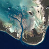
URUGUAY....Sensor Terra/MODIS...Visualization Date 2002-12-24....Credit Jeff Schmaltz, MODIS Rapid Response Team, NASA/GSFC.This true-color Moderate Resolution Imaging Spectroradiometer (MODIS) image from December 21, 2002, shows the onset of Southern Hemisphere summer across Argentina (left), Uruguay (center), and southern Brazil (upper right.) From the flat grasslands of Argentina, known as the Pampas, the terrain transitions to gently rolling hills in Uruguay. The terrain rises still more in southern Brazil. The Parana River makes a wide, dark green swath running through eastern Argentina before joining with the Uruguay River along the western border of Uruguay and emptying into the Rio de la Plata Estuary. At the mouth of the Rio de la Plata (south side) a gray patch indicates the location of Buenos Aires.


Add a comment...
Your name:
Your e-mail:


About 23

About 23
What is 23 and who's behind the service?
Just In
Discover the world from a different angle.
Here's a crop of the latest photos from the around the world.
Search
Search photos from users using 23
Help / Discussion
Get help or share your ideas to make 23 better
23 Blog / 23 on Twitter
Messages and observations from Team 23
Terms of use
What can 23 be used for and what isn't allowed
More services from 23
We also help people use photo sharing in their professional lives
  • Basque (ES)
  • Bulgarian (BG)
  • Chinese (CN)
  • Chinese (TW)
  • Danish (DK)
  • Dutch (NL)
  • English (US)
  • French (FR)
  • Galician (ES)
  • German (DE)
  • Italian (IT)
  • Norwegian (NO)
  • Polish (PL)
  • Portuguese (PT)
  • Russian (RU)
  • Spanish (ES)
  • Swedish (SE)

Popular photos right now